
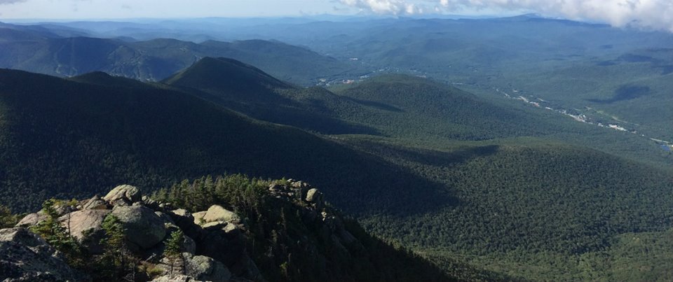
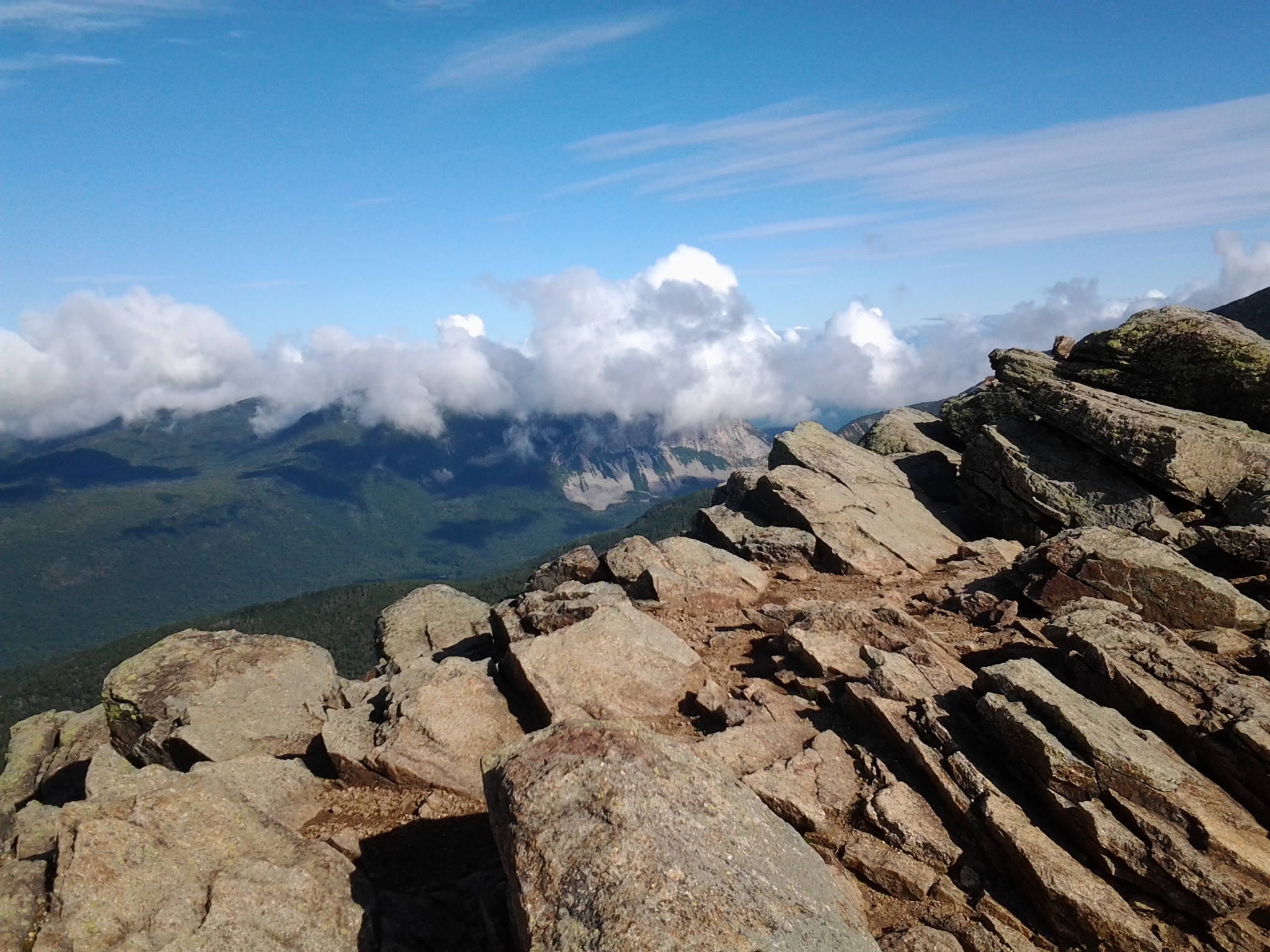
Panorama from Mt. Liberty. courtesy J. Sanderson
I’ll start this post by saying, just say yes. Say yes, even if you are pretty sure you are not trained enough to tackle it. Say yes because this might be the only chance you will get.
This is turning out to be one helluva Summer Of Adventure. Between planning for and then executing the whole Dames Across Rhode Island run, putting our house on the market with another fantastic sell-everything-not-nailed-down yard sale, pacing at Vermont, dealing with a Prius that decided to shed its mortal coil (hybrid battery bailed at 250K miles – well WELL past its warranty) and discovering the newly opened DeKoppet Preserve (more on that in another blog post…), the summer has gone by in a whir. Back in June, my friend Janet asked if I would be interested in running the Pemi Loop. My first thought was, OF COURSE I WOULD! But then I looked at the calendar. We had another thing planned coinciding with Janet’s planned traverse. I put it out of my head for awhile as a maybe, while still staying in touch with the planning on Facebook. Mary, Janet’s friend and fellow runner, who ended up pacing my last desperate miles at Dames Across Rhode Island, would also be attempting the Pemi Loop, as well as fellow TARC runner extraordinaire Annette, as well as Laura, a runner from Connecticut with a 3:38 marathon time. This was turning out to be a good group of strong women. Janet recruited Brenda, a friend from Trail Animals Running Club (who originally planned to run Dari), and as the summer wore on, I had to make up my mind: should I go? When the Other Planned Event fell through, I had no more excuses. I should go.
The Pemi Loop traverse circles through the Pemigwasset Wilderness in the White Mountains of New Hampshire. Starting and ending at the Lincoln Woods Trailhead off of the Kancamagus Highway, it can be run/hiked either clockwise or counter-clockwise. It is thirty two miles, and crosses about nine peaks, with the option of adding three more. Much of the trail is on exposed ridge; below the ridge, the trail is often rocky (it is the granite state, after all) and either descending or ascending one of its many peaks. The trail never goes around. The weather can be tricky and change quickly. Our forecast showed perfect conditions: a high pressure system would sweep out all the humidity and heat, bringing in clear, sunny conditions.

courtesy gearx.com
Adventure is one thing, keeping up with a group of strong fast women is another. This has been a cruelly slow summer for me. Sure, I have logged plenty of miles, but none of them have been fast. With nothing in particular to train for after DARI, I ambled from one trail race to another, to half marathon on road to long bike ride, training runs consisting of the odd eight mile dirt road commute to work, or a weekend 20 miler with plenty of walking; nothing terribly taxing, although the summer has been a hot one. While I knew I was going in to this under-trained, slow but strong, I had a deep desire to meet the challenge. I sent a message to Janet et al... I would be joining them!
In the weeks leading up to the traverse, we all did our homework. Annette messaged that she was a no-go; she needed time to heal an injury from her wicked cool adventure in Scotland. So now we were down to five of us. In a party-line call a few days before the run, we all laughed and planned for what we imagined would be a 12-14 hour adventure. We weren’t shooting for any fastest known time, but we certainly could come in by sunset, in time for a nice dinner at the Woodstock Inn, and maybe a sit in the condo’s hot tub. I packed a bikini in my overnight bag. A little voice inside my head said, um, you know? This thing has mountains… lots and lots of them. Reading blogs by both mountain runners and hikers, I couldn’t decide if we were being overly optimistic, or whether I was being unnecessarily wary, but something worried me it was going to take a little longer. I had done, three times – once in very foul, cold weather – the western ridge trail from Haystack to Lincoln and Lafayette and down again – and all three times it had taken all day – eight or nine hours – to hike it. I wasn’t sure we would be much faster with the running, but I hoped we would. In fact, as I glossed over the elevation map, I had visions of the group of us gliding effortlessly across the ridge trail once we came out at tree-line. Because once we were up there, it would be flat and smooth ridgeline, right? Plus, I had the optimism of my fellow runners. We bolstered each other on the ride up, and over a great dinner at Portland Pie Company.


Arriving at the condo, we made last minute preparations before going to bed. I packed everything into my “kitchen sink” Ultimate Direction SJ hydration vest. I probably had two pounds of food – sliced turkey smooshed between four slices of Italian bread, cut into eight squares. A bag of cheezits, one of fig newtons, one of dried fruit and nuts. Three Builders’ bars, some Honey Stingers’ chews, and extra NUUN caps for my many water bottles. My pack’s bladder leaked the moment I put water in to it; three distinct holes told me a fork must have been in the sink the day I washed it. Brenda loaned me two collapsible 16 oz bottles which I filled and stuffed in the big pocket on the back, and with two bottles in the front – one with a Katahdin filter – I had 64 oz of water. All told my pack, including above-treeline just-in-case clothing and emergency gear, plus styling 1980s fanny pack added 20 lbs to my summer-solid frame. It was going to bounce. Oh well. We went to bed, sleeping a few hours before the alarm cut in to the dawn.
Flume (4,328), Liberty (4,459), Little Haystack (4,780), Lincoln (5,089) and Lafayette (5,260)
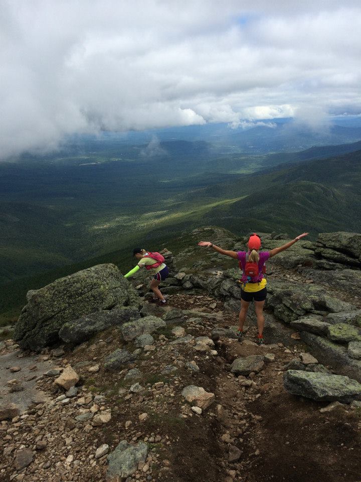
We set out at 5:39 from the Lincoln Woods parking area, everyone cheerful and ready for the day. From the flat, easy Lincoln Woods trail, after a mile or so we turned left to ascend on the Osseo trail, which gently climbs (until it’s not so gentle and your heart is going BANG! BANG! BANG!) a granite-bouldered trail, reaching the summit of Mt. Flume in about an hour and a half. The weather was PERFECT. The small summit boasted stunning views, just an appetizer to the main course. We paused to take photographs, take stock of how we were feeling. I could not help but admire the grace and ease Mary and Janet showed taking the lead on the climbs. Laura stayed not far behind them. Brenda and I brought up the back. Janet was so happy that this had all come together and that we were all out here enjoying it. That feeling was contagious – soon we were all skipping along the small ridgeline trail on our way to Mt. Liberty. At one point, an emergency beacon app I had bought for my phone suddenly went off. It sounded like a school fire alarm. What the hell is that? Is that coming from the valley? No, it’s coming from MY PHONE! I struggled to turn the darned thing off and prayed it didn’t really send a signal but merely sounded an alarm. How random! Why had it done that? I put my phone in airplane mode and forgot about it.


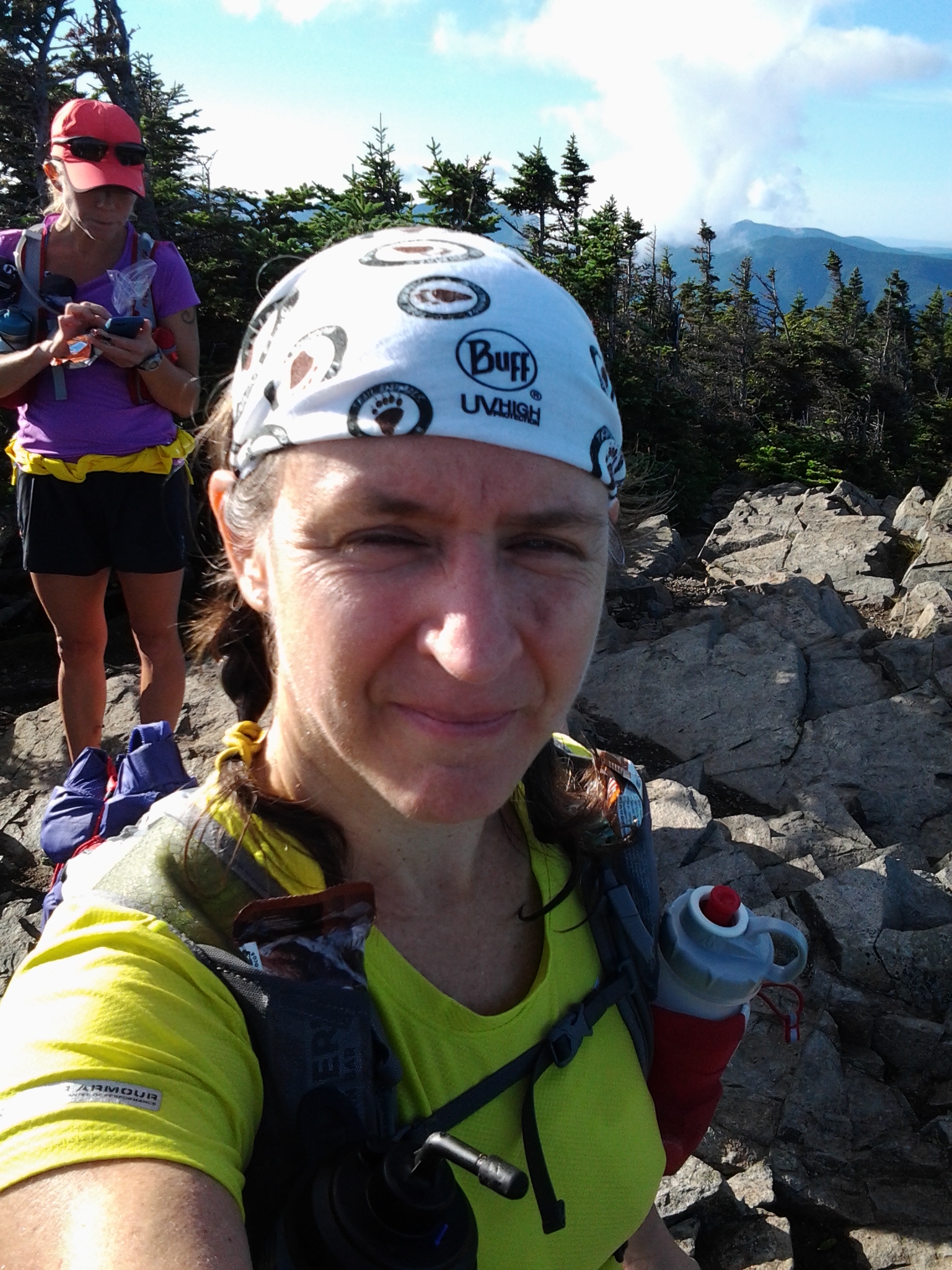


What a beautiful day. Sunny, 70 degrees, with light clouds riding the front. Ahead, the visible peaks of Liberty, Haystack, Lincoln and Lafayette showed us what was to come. It was hard to believe that from here, we would eventually be over there. Looking east, we could make out where we would be even later that day.
We actually ran some between Flume and Liberty. The trail stays fairly well at elevation, and was mild up and down, plenty rocky. It was walk, jog, run, step through some rocks, run a little, walk some more, for a couple of miles. Out along the knife edge of a cliff, into the low woods again. Suddenly, we emerged at Liberty, another summit that seemed less like a summit and more like the shoulder of the big summits to come. From here, we could see the ridge trail ahead, exposed and open to the weather, which fortunately was fine. We descended back down into the woods, and then down a steep side trail 800 feet to Liberty Springs campsite to get water. We were all pretty good with water at that point but the next water stop would be much further, so we chugged a few ounces to make room and then filtered some more to carry. Back up the side trail with mountain-cold spring water chill against our backs, we moved along. Soon, we ascended Haystack, and at that point, we were out on the ridge. On a bad day, this trail can feel like Siberia. Today, it was all skipping and hopping through alpine rock and granite-hugging stunted greenery. We stopped to admire the views, and I started my routine of eating something at each stop. Keep fueled, keep happy. I did not sit down. I generally don’t on these things. It is too hard to get back up. I tried to pay attention as my brain dueled with the two purposes of getting the trail done, and seeing the world around me.
From here, the trail from the junction of the Falling Waters trail (which ascends steeply from a busy parking area a couple of miles below) until the other side of Lafayette has often been described as “Grand Central station.” There were day hikers, AT Thru Hikers looking dirt-tatoo’d and weary, families with little hiker children, and runners like us. Although it was only Friday, I counted fifty people between Haystack and Lincoln. Conversations melded together as hikers and runners passed in both directions. Janet, Laura and Mary were up ahead; Brenda and I were laughing at some private joke, as if these crowds, this herd of people, were not all around us. There were a lot of high-school groups. One young boy descending the rocks toward us with a sour look on his face had on a New Order t-shirt beneath his over-sized pack. I said hello, complimented him on his shirt. He said Thank you like a high schooler would say politely to his friend’s mother. “I hope he didn’t steal that shirt from his grandfather” I said out loud. Someone chuckled. We were in two lines: one going up, one coming down. Everyone was talking, everyone was snapping pictures, admiring views, shouting to friends, parents snagging the collars of over-zealous rock-hopping children. The land drops off on either side. I recalled to Brenda my time up here in a storm. It seemed to take forever in the high winds and cold rain to get from one blasted rock to another. By contrast, today we easily climbed up the rocks and could see our destination. At some point, the stupid alert app went off again. I quickly shuffled off my pack, reached for my phone and pressed around until it turned itself off again. “If this thing does this again, I’m uninstalling it.” After a third false alarm, I uninstalled the app and shut my phone off. Pay attention. I thought to myself. You’ve only been up here three times and there is still so much to see. See that slide over there with mica shining in the sun? See the clouds backed up against Mount Lafayette? Hear the breeze against the rocks?
It was all so pretty, overwhelmingly so.


The atmosphere on top of Mt. Lafayette – a whopping 5,000 plus feet – was jubilant. Lafayette is a sort of a crossroads; turn left, and one can descend to Greenleaf hut, and eventually to the Lafayette parking lot and route 93 far below. Our option was straight ahead, continuing over the summit ridge to descend, open views all around, another tumble of rocks, as if a giant child had thrown a handful of boulders down a long alley. Most of the hikers were back at Lafayette. It was much quieter here. Brenda and I hiked with an older guy – maybe in his late sixties? – who reminisced about bare-booting the Bonds trail in the dead of winter. Those were the days. No one does that, now. He teased us about our long day ahead. “The Pemi Loop? Hope you brought headlamps!” We laughed. I glanced down at my watch and saw that we were seven hours in and not yet to our halfway point. So much for our 14 hour goal. But then, they said it was easier on the second half… I thought of this as I clomped down the exposed granite and looked around. Nothing but beautiful green wilderness as far as the eye could see, and granite trail beneath the toes.
Garfield Ridge Trail, Mt. Garfield (4,500) and the madness of PUDs
Now began the Garfield Ridge Trail, down from Lafayette, leaving Ted Our Old Timer Hiking Friend at the Skookumchuck trail (the word means, according to Wikipedia, “strong water’). Brenda and I descended into a series of PUDs (Pointless Ups and Downs). We hiked fast, hoping to catch up with the other three. Time seemed to slow. Below treeline, the trail now offered less for views and our eyes were busy scanning the trail ahead for foothold and loose boulder. Being unfamiliar with this portion of the trail, I had little expectation, but it did seem to go on. and on. and on… Eventually it turned upward, and soon we summited Garfield. A guy at the top, munching on a granola bar with a handsome black lab by his side told us our friends had just been there before us. We took the quick side trail to inspect the base of what once was the fire tower and to listen to the wind against the rocks at the top. 360 degrees of gorgeous. A French-Canadian couple lunched at the base of the tower. Hopping down near them, we asked if they knew which way the trail went, since it wasn’t readily apparent. We spent a few minutes with them looking for it, and finally found we had to go back down to where we had gone off the trail to come up. Once there, we ran into another group of summit dogs. I love meeting the dogs.
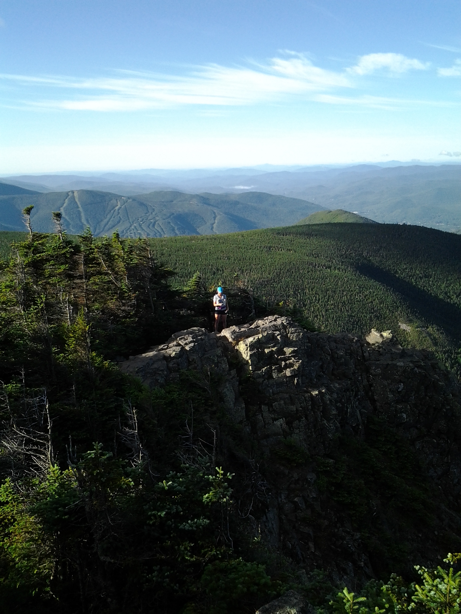
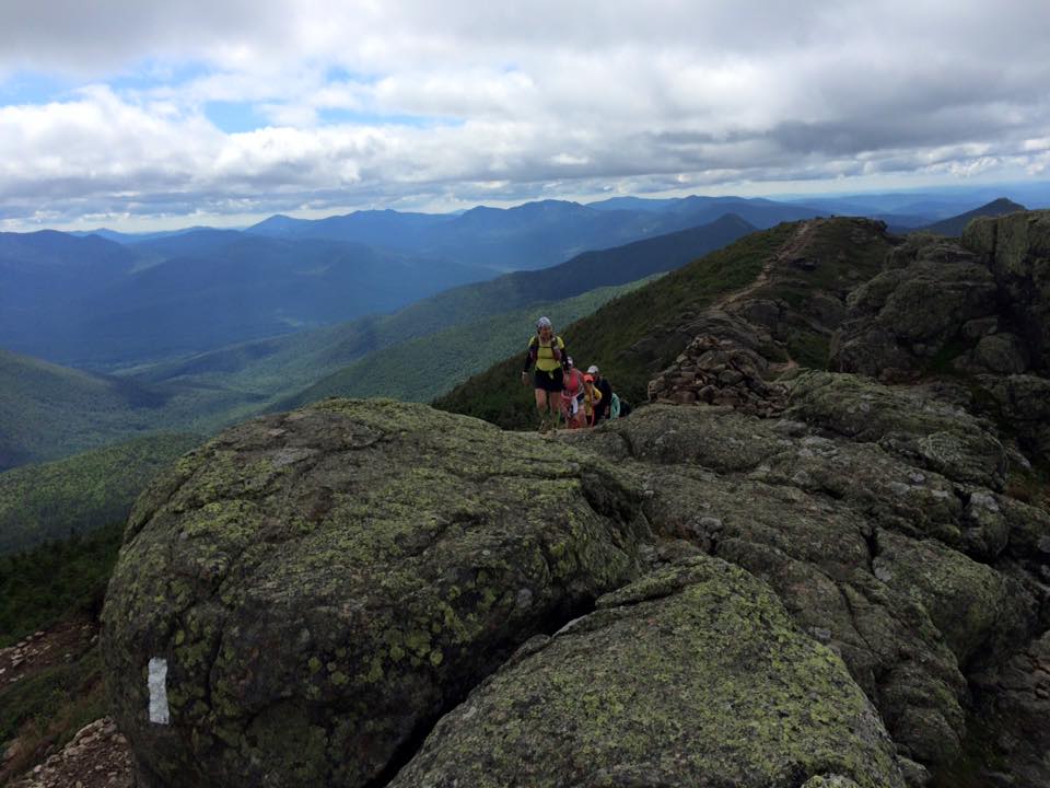
Laura and Mary descend. courtesy J. Sanderson
We were well behind the rest of our group, and it was getting on to late afternoon. Coming off of Garfield, a sign read 2.9 miles to Galehead hut, which is where we were headed to meet up with our gang. More granite bowling balls, a stop at the campsite to filter more water, another drop, and suddenly, just around a bend, the trail was IN a waterfall. I have hiked wet trail before, but this was exceptional. Steep, wet, with running water right down the middle, I had a moment of panic as I reached for a tree root and it pulled away from the rock. It took us nearly an hour to do that mile. Oy vey! Beyond that (finally!) we roller-coastered along rocky up and down trail. At one point, in the distance, we could see the Galehead hut, our next destination. It seemed incredibly far away from us. Around Garfield Pond we looped, and as the trail ascended again I thought to myself that this just HAD to be the ascent to the hut – because, well, it just HAD to be. My right ankle was twitchy and giving me some pain from turning it several times through the bowling ball trail. We passed a family with wee hiker children with their wee hiker backpacks. Up ahead, we came to a clearing, emerged from our climb to another juncture and there, there was the hut. Our halfway point, and we were nine hours in.
An AT thru-hiker hailed as I passed. “Are you coming from the South or the North?” I hesitated… didn’t we just come from the West? “uh, the West.” He scowled. “Yes but… on the AT it’s always North or South.” “Oh, then, uh, I guess the South.” He asked if we’d seen one of their friends, and we had, so we told him that we had seen her by the waterfall-trail and she had been hiking fairly well (as well as could be with a big AT pack and, well, the waterfall trail.) Brenda and I wasted little time getting up on the porch and inside. And there was Janet, Laura and Mary. Hugs all around. They had been worried about us. They had been waiting 45 minutes. They had had soup. There was no more soup, but I spied a coffee pot and went right to it. We refreshed, re-hydrated, re-fueled, and all caught up, and I insisted that if we happened again to get separated that they not wait. Brenda and I would be fine. But that’s not how Janet, Laura and Mary roll – they would wait for us on each of the following ascents and junctures ahead, because we were doing this together. As we talked and regrouped, I watched as families came in for the night, the end of their days and a good night’s sleep ahead. It was now 5 o’clock. Laura was feeling some stomach issues but was ready to press on.
South Twin (4,902), Mt. Bond (4,698), and Bondcliff (4,265)
We left Galehead hut to ascend South Twin Mountain. You know those stair machines at the gym? You know how they have like big, non-standard 14 inch steps? They would be perfect training for the ascent of Twin Mountain. The sun blazed on our backs as once again, we watched Mary and Janet glide on up ahead. Laura stayed back, dealing with her stomach, but soon found her wind and pushed out ahead of Brenda and me. Within minutes, they were lost to our view, and Brenda and I took turns pushing each other up the granite-strewn trail. I had known it was coming – I had read all about it – but it still surprised and humbled me with its relentless UP. At this point, we had been moving forward for twelve solid hours. It was pointless to whine, because we were all doing this together, we were all tired, but we were all amazingly strong and capable. And the best part was that we all knew it – for my part, I felt secure in this experienced company of women – that Janet could not have picked a better bunch. If anyone was the weak link, it was me, because I was slow. But otherwise, there was no doubt we would all be able to handle what was to come.


I have to admit it was hard at the top of South Twin when I saw how Laura, Janet and Mary had waited, yet again, for what looked like long enough to get cold, when we had barely gotten there and caught our breath. And I felt guilty about that. It was discouraging to feel that I was slowing them down. I had to take a moment to back it up in my brain and remember what we were doing this for. It was not a race! And some people are just naturally good at this, and dedicated to their fitness, and instead of discouraged I should feel inspired. Attitude change with altitude change!
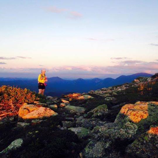
Attitude summarily changed, we pressed on at a light jog to Bond on a truly luxurious softer trail just below treeline. What a beautiful, beautiful place to be. Finally finding flow on the quiet trail, the day’s frustrations left me. Quiet all around. Green summits in all directions. At the top of Mt Bond, a lone hiker took our photograph while we watched the sun get lower across the sky to the West, the way we had come. I fantasized momentarily about stretching out against the rocks, finding a good old rock pillow, and spending the night alternately sleeping like the dead and waking to watch the stars… ah… if only. We had miles to go. The hiker told us his brother was coming up the trail that we were going down, and to say hello. On the way down, we saw the brother, and I recognized the face – it was the one I had on earlier. The slow-hiker face. The holding-them-up face. I mentally wished him well, knowing he had a ways to go before their campsite. “Hope you all have headlamps” he said, as we passed.


Descending Bond, Mary turned to us and said, part motherly, part efficient cheer-meisterly: “Now, see Bondcliff up ahead? That’s our last mountain.

We have to get over that before sunset. We DO NOT want to be on the hard part of that descent after sunset.” We worked our way along this very, very rocky trail. Our ankles were quite tired, and our quads were sore, and OH, the views. Oh. To sit, to stare off into the never-ending wilderness, the sun sinking just beyond a tall peak in the distance, was all that the heart desired. The siren call of summit views. To our right, just feet from where we walked, the side of the ridge dropped sharply to a valley below. Ahead, the impressive summit of Bondcliff loomed. All ideas of time and what could be accomplished seemed to be swept from my head. It was 7:45 and sunset was in 30 minutes, if that. Beyond Bondcliff, the trail would go down – at first sharply, then less steeply, then eventually “boring and flat” another eight or ten? miles. I didn’t see us finishing before ten. So much for dinner out. Someone joked about food at the 24 hour CVS.
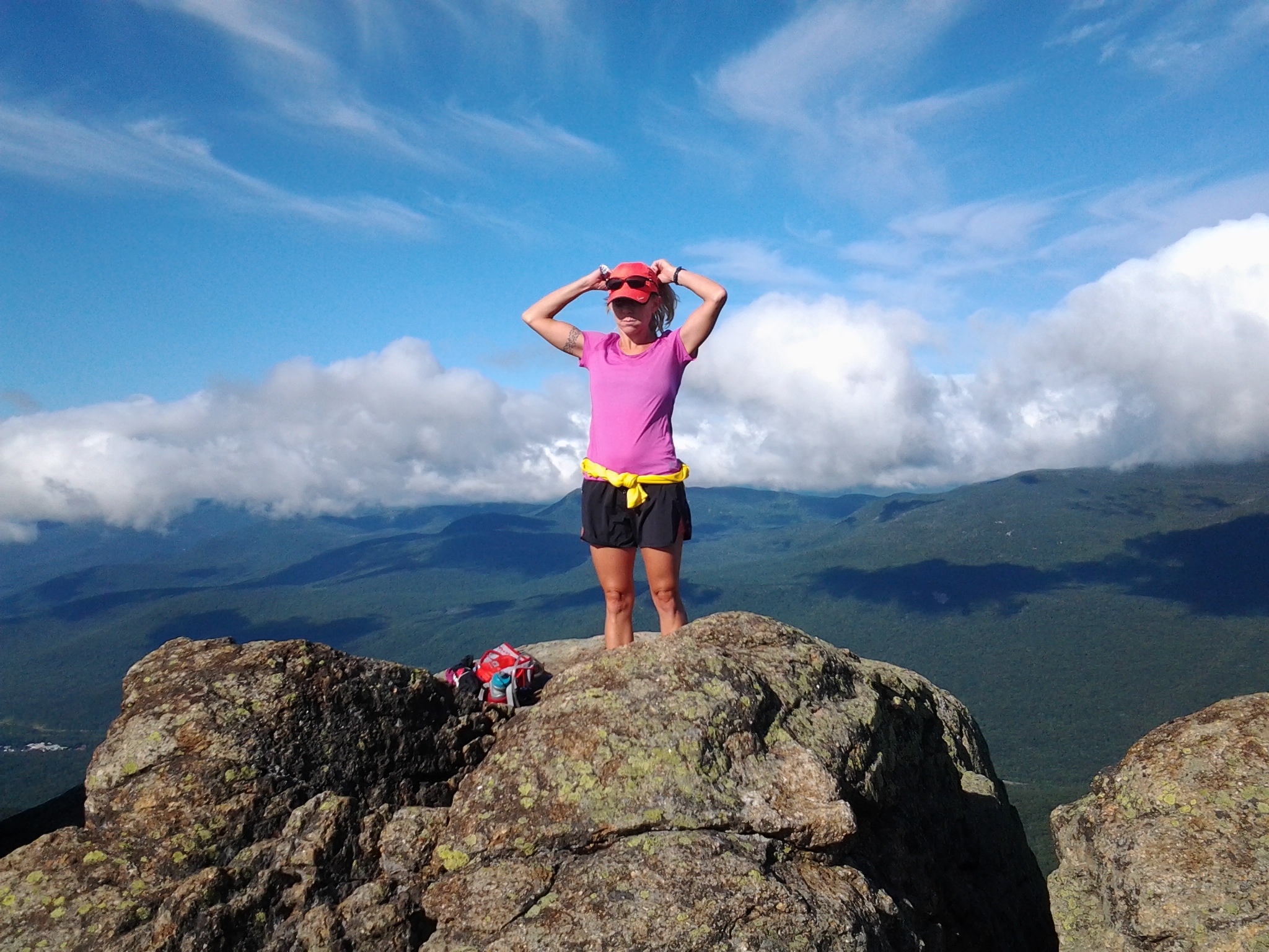
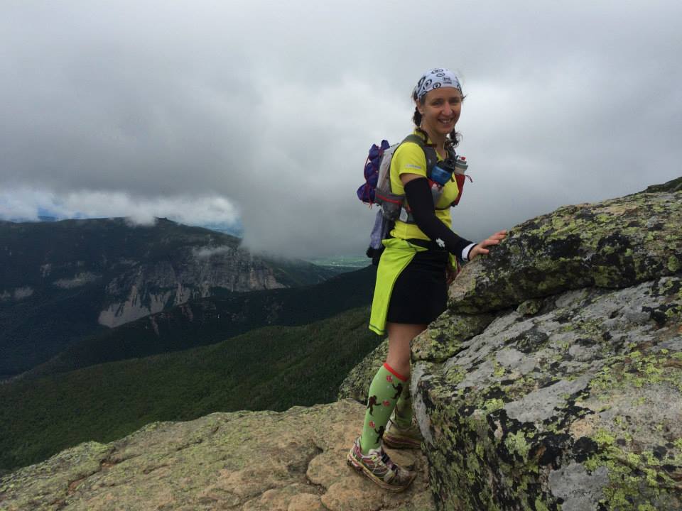
Janet and Laura pressed ahead, following Mary, who was anxious and therefore moving fast. Brenda and I dawdled, not yet willing to give up what we had climbed so hard to see. To our left, shadowed by our own mountain, the closer hills hugged in varying shades of green. The granite looked scorched, reflected in the red of the dropping sun. A few minutes of running along a spine of ridge, and then another climb. Past cairns and between low stone walls, we made our way up Bondcliff. At the top, Brenda took a few minutes to climb out on the profile and I snapped her photo while she snapped mine.

Up ahead, a man in a blue running shirt with a big camera took photos of the sunset from a daring position at the cliff’s precipice. The mother in me wanted to drag him back from the edge and lecture him on safety. I’m pretty sure that his photographs of that day are awesome and were worth his precarious perch. We hiked past him, once again finding ourselves descending a mountain, the last of the day. A very quick few hundred feet of serious downhill – hands required and granite-hugging, knee scraping drops – and we emerged in a little clearing where the other three waited for us. “Yay!” we cheered, celebrating getting off of the mountain just before sunset. Headlamps on, we now prepared to descend the last of the trail, a few hours ahead of hiking by headlamp and stars. At one point, the photographer we had seen ran down past us. And then it was just us for a long time.
My headlamp is pretty strong*. At river crossings, someone would call me to the front so I could point the beam forward to see where the trail led. We crossed the creek leading to the East Branch of the Pemigwasset several times. In the dark, with rocks flattened by my headlamp, I lost my usual rock-hopping fear and found myself crossing with ease, despite being tired. I wanted badly for Brenda and I to keep up with Laura, Janet and Mary. We were moving in a train, down the hip of the mountain, easing our way back. Songs came into my head. Very bad jokes were passed around. I thought about how lucky I am. Truly. How many people can be thrown together like this, use everything they had for eighteen hours, and come out in the end with a smile? While we were all tired, and desperate for our sleeping bags, something in me wanted to bottle this moment of fatigue and camaraderie… five women walking in a line, in the footsteps of so many before us, alternately quiet and rambunctious on the night trail. At some point, this night would be over, we would be back at the car, back at the condo, showered and done and part of us wishing we were still out there.
The trail finally emerged back on the flat former railroad bed of the Lincoln Wood Trail, described by everyone we passed as “boring and flat”, and we resumed what we had left in our legs of a running pace. The job here was to avoid tripping on old leftover rail ties. Other than that, it was wide enough for a truck and good for running. We ran, walked, ran, walked. I got ahead, for the first time that day, and turned off my high powered coal-miner’s headlamp to walk blindly in the dark. On again, off again. I could hear the others behind me. What a day. Finally, after almost exactly eighteen hours, we emerged onto the bridge across the river, only a stone’s throw from the parking area. We turned off our lamps and looked up at the carpet of stars. Laura pointed, “a shooting star!” Lucky us. Make a wish. It might just come true.
* shameless, unsolicited plug for the Petzl Tikka R+, which has never failed me and goes hours on a charge.
Our Pemi Loop adventure came out differently in different measurements. I measured us at 28 miles, but Mary tells us it was 31 point something. In all, with stops of about 1.5 hours, our traverse took 18 hours. Out of the food I brought, I was left with three wedges remaining of the two sandwiches; half of the Cheez-its, most of the fig newtons, and a handful of nuts and dried fruit. All but one bite of the bars were gone. I had used two NUUN tablets and gone through about 5.7 liters of water. At different points, I wore all the clothes I brought except the tights. I did not need the backup headlamp but I recommend one anyway.
I want to say thank you thank you thank you Janet Sanderson for getting us all to agree to do it, for planning the adventure, and securing the awesome accommodations. Mary deserves mucho praise & hugs for her never-ending optimism and leadership. I am glad I got some time to hike with lovely Laura, whose still waters run deep, and whose persistence and strength in the face of feeling like crap is inspiring as hell. And many thanks to Brenda Morris, the most cheerful ultra-runner out there, who sure knows how to make a long slog the most fun thing ever. We went in smiling, and we came out smiling.

